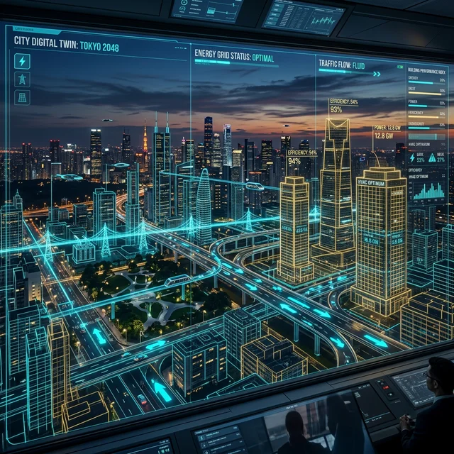
More Than a Buzzword
"Digital twin" has been used loosely enough across industries to lose much of its meaning, but in urban planning the concept has a fairly concrete definition: a continuously updated, data-driven 3D model of a city that planners can use to simulate changes before committing to them in the real world.
What's Actually Being Modeled
Current municipal digital twin projects typically combine traffic sensor data, utility infrastructure maps, building energy data, and weather and climate modeling into a single simulation environment. Planners can then test scenarios — what happens to traffic if this road closes, how would a heatwave affect this specific neighborhood's grid load — without disrupting the actual city to find out.
Where This Is Furthest Along
The most developed implementations have focused on traffic and infrastructure stress-testing, since that's where the underlying sensor data is already richest and the payoff from avoiding a bad real-world decision is clearest and most measurable. Climate resilience modeling — flood risk, heat island effects — is a fast-growing second use case as more cities face acute weather-related infrastructure stress.
The Real Constraints
Building and maintaining an accurate digital twin requires continuous, high-quality sensor data feeding the model, which many cities — particularly smaller or lower-budget municipalities — simply don't have the infrastructure to provide yet. There's also a meaningful gap between a flashy demo and an operational tool actually used in day-to-day planning decisions, and most cities are still closer to the former.
Why It's Worth Following Anyway
Even partial digital twins are already changing how some infrastructure decisions get made, shifting planning from intuition and static reports toward testable simulation. As sensor costs continue falling, expect more mid-sized cities to attempt versions of this, even if the most sophisticated implementations remain concentrated in well-funded major metros for now.
What a City Digital Twin Actually Contains
A city digital twin is a continuously updated virtual model of a city's physical infrastructure, built from sensor data, satellite imagery, building information models (BIM), and traffic telemetry. The most sophisticated implementations include:
3D building model integration — Lidar scans and photogrammetry combined with BIM data from construction permits create accurate 3D representations of all buildings. Singapore's Virtual Singapore project created a 3D model accurate to 10 centimetre resolution.
Real-time infrastructure data — Water pressure sensors, power grid monitoring, traffic sensors, and air quality monitors feed live data into the twin, creating a real-time state of city systems rather than a static snapshot.
Underground infrastructure mapping — Utility routing (water, sewage, gas, electrical, telecommunications) is mapped and integrated, solving the historical problem where utility companies maintained separate, incompatible records.
Simulation layers — The real value emerges from simulation: urban planners can model the impact of proposed developments on traffic, shadow patterns, air flow, emergency vehicle access times, and utility load before construction begins.
Cities with Operational Twins
Singapore — The most advanced city digital twin, maintained by Singapore Land Authority. Used actively for planning decisions, emergency response planning, and telecommunications network optimisation.
Helsinki, Finland — Helsinki3D+ project provides a complete 3D city model with real-time data layers for traffic and environmental monitoring, publicly accessible.
Orlando, Florida — NVIDIA partnership to build a real-time digital twin using Omniverse platform, focused on autonomous vehicle simulation and smart traffic management.
Zurich, Switzerland — Uses digital twin for energy consumption modelling and renovation subsidy targeting — identifying buildings most likely to benefit from heat pump subsidies based on simulation of efficiency improvements.
The Data Governance Challenge: City digital twins raise significant data governance questions that are only beginning to be addressed. A real-time model of a city captures movement patterns, building occupancy, and utility usage at a resolution that could enable surveillance at scale. Singapore's Virtual Singapore project operates under strict data access controls; other cities' twins have less clearly defined governance frameworks. The technology's planning benefits are real, but establishing clear rules about who can access the data, for what purposes, and with what oversight, is a precondition for public trust.




























































Commenting is currently unavailable on this article.